Файл:Andros Island-1844.jpg
Оригинален файл (1091 × 1431 пиксела, големина на файла: 178 КБ, MIME-тип: image/jpeg)
| Този файл е от Общомедия и може да се използва от други проекти.
Следва информация за файла, достъпна през оригиналната му описателна страница. |
Резюме
| Описание |
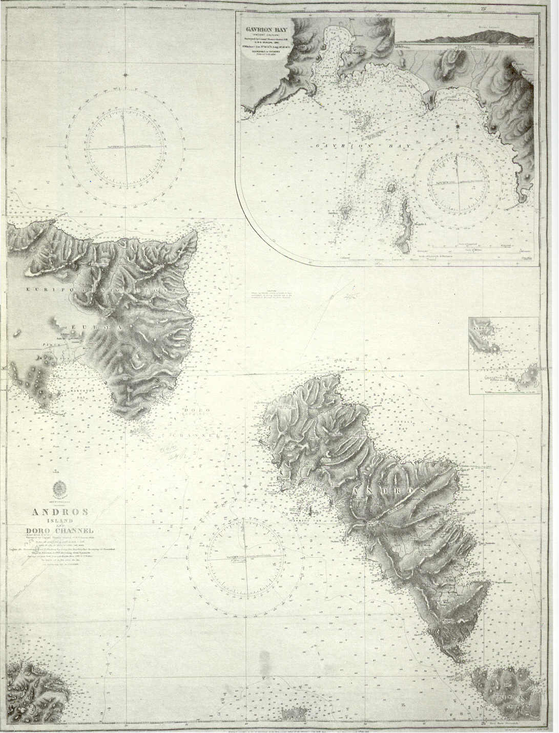
English: Admiralty chart of Andros Island and Cape Doro strait (today Kafireus Strait), Greece. Includes a large scale chart of Gavrion Bay (1844). Ελληνικά: Ναυτικός χάρτης Στενού Καφηρέως - Ν. Άνδρου του Βρετανικού Ναυαρχείου με ένθετο χάρτη μεγάλης κλίμακας του Όρμου Γαυρίου (1844). |
| Дата | |
| Източник | http://www.hellenicnavy.gr/upload/UALASIA_PERIGRAFH_THS_ANDROY_1844.jpg |
| Автор | Office of Hydrographer to the Admiralty, headed by Admiral Beaufort |
Лицензиране
This image is in the public domain because it is a mere mechanical scan or photocopy of a public domain original, or – from the available evidence – is so similar to such a scan or photocopy that no copyright protection can be expected to arise. The original itself is in the public domain for the following reason:
This tag is designed for use where there may be a need to assert that any enhancements (eg brightness, contrast, colour-matching, sharpening) are in themselves insufficiently creative to generate a new copyright. It can be used where it is unknown whether any enhancements have been made, as well as when the enhancements are clear but insufficient. For known raw unenhanced scans you can use an appropriate {{PD-old}} tag instead. For usage, see Commons:When to use the PD-scan tag.  |

История на файла
Избирането на дата/час ще покаже как е изглеждал файлът към онзи момент.
| Дата/Час | Миникартинка | Размер | Потребител | Коментар | |
|---|---|---|---|---|---|
| текуща | 14:20, 8 август 2008 | | 1091 × 1431 (178 КБ) | Sv1xv | {{Information |Description={{en|1=Chart of Andros Island and Cape Doro strait, Greece}} |Source=http://www.hellenicnavy.gr/upload/UALASIA_PERIGRAFH_THS_ANDROY_1844.jpg |Author=UK Admiralty |Date=1844 |Permission={{PD-old}} |other_versions=PD-old }} {{Im |
Използване на файла
Следната страница използва следния файл:
Глобално използване на файл
Този файл се използва от следните други уикита:
- Употреба в ar.wikipedia.org
- Употреба в el.wikipedia.org
- Употреба в en.wikipedia.org
- Употреба в gl.wikipedia.org
- Употреба в it.wikipedia.org
- Употреба в ru.wikipedia.org
- Употреба в tr.wikipedia.org
- Употреба в zh.wikipedia.org