Файл:Enderby Land, Antarctica.jpg

Оригинален файл (1750 × 1300 пиксела, големина на файла: 465 КБ, MIME-тип: image/jpeg)
| Този файл е от Общомедия и може да се използва от други проекти.
Следва информация за файла, достъпна през оригиналната му описателна страница. |
Резюме
| Описание |
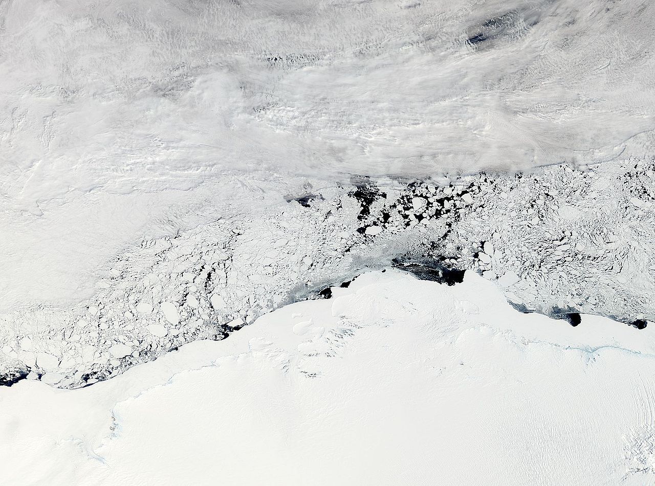
NASA image acquired November 3, 2011 The Moderate Resolution Imaging Spectroradiometer (MODIS) instrument on NASA's Aqua satellite captured this image of Enderby Land, Antarctica on November 3, 2011 at 11:20 UTC (7:20 a.m. EDT). The ice and snow appear bright white at the bottom of the image. Clouds grace the top of the image, and sea ice floats in William Scoresby Bay. Enderby Land is an Antarctic land mass that extends from Shinnan Glacier to William Scoresby Bay. Discovered in 1831, it was named after the Enderby Brothers of London. Operation Ice Bridge is exploring Antarctic ice, and more information can be found at www.nasa.gov/icebridge. Image Credit: NASA Goddard MODIS Rapid Response Team NASA Goddard Space Flight Center enables NASA’s mission through four scientific endeavors: Earth Science, Heliophysics, Solar System Exploration, and Astrophysics. Goddard plays a leading role in NASA’s accomplishments by contributing compelling scientific knowledge to advance the Agency’s mission. |
| Дата | |
| Източник |
NASA Satellite Sees Enderby Land, Antarctica
|
| Автор | NASA Goddard Space Flight Center from Greenbelt, MD, USA |
Лицензиране
- Можете свободно:
- да споделяте – да копирате, разпространявате и излъчвате произведението
- да ремиксирате – да адаптирате произведението
- Съгласно следните условия:
- признание на авторството – Трябва да посочите авторството, да добавите връзка към лиценза и да посочите дали са правени промени. Можете да направите това по всякакъв разумен начин, но не и по начин, оставящ впечатлението, че същият/същите подкрепят вас или използването по някакъв начин на творбата от вас.
| This file is in the public domain in the United States because it was solely created by NASA. NASA copyright policy states that "NASA material is not protected by copyright unless noted". (See Template:PD-USGov, NASA copyright policy page or JPL Image Use Policy.) | ||
 |
Warnings:
|
| This image, originally posted to Flickr, was reviewed on November 8, 2011 by the administrator or reviewer File Upload Bot (Magnus Manske), who confirmed that it was available on Flickr under the stated license on that date. |
История на файла
Избирането на дата/час ще покаже как е изглеждал файлът към онзи момент.
| Дата/Час | Миникартинка | Размер | Потребител | Коментар | |
|---|---|---|---|---|---|
| текуща | 03:34, 8 ноември 2011 | | 1750 × 1300 (465 КБ) | File Upload Bot (Magnus Manske) | {{Information |Description=NASA image acquired November 3, 2011 The Moderate Resolution Imaging Spectroradiometer (MODIS) instrument on NASA's Aqua satellite captured this image of Enderby Land, Antarctica on November 3, 2011 at 11:20 UTC (7:20 a.m. EDT) |
Използване на файла
Следните 2 страници използват следния файл:
Глобално използване на файл
Този файл се използва от следните други уикита:
- Употреба в ar.wikipedia.org
- Употреба в arz.wikipedia.org
- Употреба в ca.wikipedia.org
- Употреба в ceb.wikipedia.org
- Употреба в ce.wikipedia.org
- Употреба в de.wikipedia.org
- Употреба в en.wikipedia.org
- Употреба в eo.wikipedia.org
- Употреба в eu.wikipedia.org
- Употреба в he.wikipedia.org
- ארץ אנדרבי
- הרי טולה
- תבנית:הרי טולה
- הרי נייפייר
- תבנית:הרי נייפייר
- הר אלקינס
- הר דנהאם (אנטארקטיקה)
- הר המפסון
- הר קייזר
- הר ריידר
- הר קינג (אנטארקטיקה, הרי טולה)
- הר סוקק
- רכס פיקוק (אנטארקטיקה)
- הר הארדי (אנטארקטיקה)
- הר אולדפילד (אנטארקטיקה)
- פסגת פיתגורס
- הר סטורר
- הר ריסר-לארסן
- הר פורטאוס
- הר ברטלט (אנטארקטיקה, ארץ אנדרבי)
- הר הארווי (אנטארקטיקה)
- נונאטאקי יאנג
- הר מילר (ארץ אנדרבי)
- הר מוריסון (ארץ אנדרבי)
- הר בסט
- נונאטאקי הארווי
- הר דאנג'י
- הר דגרפלדט
- הר רודס (אנטארקטיקה)
- הר בונד (אנטארקטיקה)
- Употреба в hi.wikipedia.org
- Употреба в hy.wikipedia.org
- Употреба в it.wikipedia.org
- Употреба в ja.wikipedia.org
- Употреба в mk.wikipedia.org
- Употреба в nl.wikipedia.org
- Употреба в nn.wikipedia.org
- Употреба в pl.wikipedia.org
Преглед на глобалната употреба на файла.