Файл:Exeter-20may44.jpg
Не е налична версия с по-висока разделителна способност.
Exeter-20may44.jpg (600 × 555 пиксела, големина на файла: 79 КБ, MIME-тип: image/jpeg)
| Този файл е от Общомедия и може да се използва от други проекти.
Следва информация за файла, достъпна през оригиналната му описателна страница. |
Резюме
| Описание |
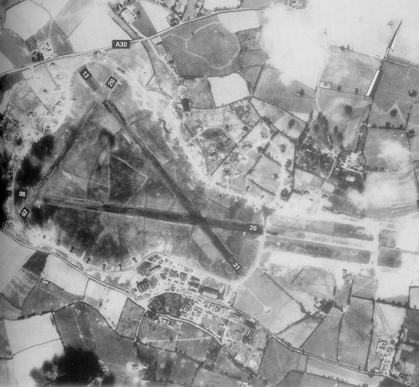
English: Exeter Airfield, England |
||||||
| Дата | |||||||
| Източник | Freeman, Roger A., Airfields Of The Ninth, Then And Now, 1993 (where the annotations are from) | ||||||
| Автор | Royal Ordinance Survey. | ||||||
| Права (Повторно използване на файла) |
|

Дневник на оригиналното качване
The original description page was here. All following user names refer to en.wikipedia.
- 2007-05-15 23:39 Bwmoll3 600×555×8 (81388 bytes) Exeter Airfield, England, 20 May 1944 Source: Royal Ordinance Survey. Crown Copyright expired 50 years after photograph taken in 1994. Annotations on photo from Freeman, Roger A., Airfields Of The Ninth, Then And Now, 1993
История на файла
Избирането на дата/час ще покаже как е изглеждал файлът към онзи момент.
| Дата/Час | Миникартинка | Размер | Потребител | Коментар | |
|---|---|---|---|---|---|
| текуща | 10:29, 21 май 2008 | | 600 × 555 (79 КБ) | Aps1 | {{Information |Description={{en|Exeter Airfield, England, 20 May 1944 Source: Royal Ordinance Survey. Crown Copyright expired 50 years after photograph taken in 1994. Annotations on photo from Freeman, Roger A., Airfields Of The Ninth, Then And Now, 1993 |
Използване на файла
Следната страница използва следния файл:
Глобално използване на файл
Този файл се използва от следните други уикита:
- Употреба в ca.wikipedia.org
- Употреба в en.wikipedia.org
- Употреба в ru.wikipedia.org
- Употреба в si.wikipedia.org
- Употреба в uk.wikipedia.org
- Употреба в vi.wikipedia.org