Файл:Lesotho rel location map.svg

Оригинален файл (Файл във формат SVG, основен размер: 765 × 765 пиксела, големина на файла: 770 КБ)
| Този файл е от Общомедия и може да се използва от други проекти.
Следва информация за файла, достъпна през оригиналната му описателна страница. |

Резюме
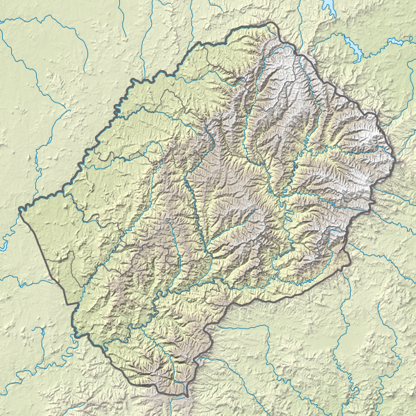
| Описание |
Deutsch: Positionskarte von Lesotho
English: Location map of Lesotho
|
||||||||||||
| Дата | |||||||||||||
| Източник |
Собствена творба, използваща:
|
||||||||||||
| Автор | NordNordWest | ||||||||||||
| други версии |
|
||||||||||||


|
This map has been made or improved in the German Kartenwerkstatt (Map Lab). You can propose maps to improve as well.
|
Лицензиране
Usage of this file with:

explanatory notes: Legally binding is only the full legalcode. For a free usage I recommend to respect the following licence conditions:
1. Provide my name as given above: NordNordWest,
2. a copy of, or the URI for, the applicable license: https://creativecommons.org/licenses/by-sa/3.0/de/legalcode,
3. the title of the work,
4. in the case of an adaptation, a credit identifying the use of the work in the adaptation.
This license and the rights granted hereunder will terminate automatically upon any breach by you of the terms of this license. Any of the above conditions can be waived if you get permission from the copyright holder. If you have questions or wish differing conditions, please contact me through nnwest or my discussion page ![]() t-online.de
t-online.de
- Можете свободно:
- да споделяте – да копирате, разпространявате и излъчвате произведението
- да ремиксирате – да адаптирате произведението
- Съгласно следните условия:
- признание на авторството – Трябва да посочите авторството, да добавите връзка към лиценза и да посочите дали са правени промени. Можете да направите това по всякакъв разумен начин, но не и по начин, оставящ впечатлението, че същият/същите подкрепят вас или използването по някакъв начин на творбата от вас.
- споделяне на споделеното – В случай, че промените, видоизмените или използвайки като основа произведението, го надградите, то полученото производно произведение може да се разпространява само съгласно условията на същия или съвместим лиценз с оригиналния такъв.

История на файла
Избирането на дата/час ще покаже как е изглеждал файлът към онзи момент.
| Дата/Час | Миникартинка | Размер | Потребител | Коментар | |
|---|---|---|---|---|---|
| текуща | 21:20, 13 март 2017 | | 765 × 765 (770 КБ) | NordNordWest | == {{int:filedesc}} == {{Information |Description= {{de|1=Positionskarte von Lesotho}} {{en|1=Location map of Lesotho}} {{Location map series N |stretching=116 |top=-28.3 |bottom=-31.0 |left=26.9 |right=29.6 }} |Source={{Own using}} * United States Nat... |
Използване на файла
Следните 5 страници използват следния файл:
Глобално използване на файл
Този файл се използва от следните други уикита:
- Употреба в ar.wikipedia.org
- Употреба в ast.wikipedia.org
- Употреба в az.wikipedia.org
- Употреба в bn.wikipedia.org
- Употреба в bs.wikipedia.org
- Употреба в ceb.wikipedia.org
- Употреба в ce.wikipedia.org
- Употреба в cs.wikipedia.org
- Употреба в da.wikipedia.org
- Употреба в de.wikipedia.org
- Thabana Ntlenyana
- Lesotho
- Katse-Talsperre
- Maletsunyane-Wasserfall
- Vorlage:Positionskarte Lesotho
- Wikipedia:Kartenwerkstatt/Positionskarten/Afrika
- Sehlabathebe-Nationalpark
- Mohale-Talsperre
- Karoo-Ferrar-Magmaprovinzen
- Ts’ehlanyane-Nationalpark
- Königlicher Palast (Lesotho)
- Maboloka (Berg)
- Likhoele
- Makoaneng
- Sefikeng (Berg)
- Sefikaning (Berg)
- Benutzer:Shi Annan/Koeneng
- Tlapaneng
- Thaba Bosigo
- Употреба в de.wikivoyage.org
- Употреба в el.wikipedia.org
- Употреба в en.wikipedia.org
Преглед на глобалната употреба на файла.