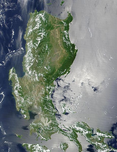
Файл:Northern Philippines (Luzon).jpg

Размер на този преглед: 461 × 599 пиксела. Други разделителни способности: 184 × 240 пиксела | 369 × 480 пиксела | 591 × 768 пиксела | 788 × 1024 пиксела | 2000 × 2600 пиксела.
Оригинален файл (2000 × 2600 пиксела, големина на файла: 738 КБ, MIME-тип: image/jpeg)
История на файла
Избирането на дата/час ще покаже как е изглеждал файлът към онзи момент.
| Дата/Час | Миникартинка | Размер | Потребител | Коментар | |
|---|---|---|---|---|---|
| текуща | 21:52, 25 октомври 2005 |  | 2000 × 2600 (738 КБ) | Brian0918 | * Credit Jacques Descloitres, MODIS Land Rapid Response Team, NASA/GSFC This MODIS true-color image of the northern Philippines shows the island of Luzon and the Cagayan River running in the plains between the Sierra Madre mountain rang |
Използване на файла
Следната страница използва следния файл:
Глобално използване на файл
Този файл се използва от следните други уикита:
- Употреба в af.wikipedia.org
- Употреба в ar.wikipedia.org
- Употреба в arz.wikipedia.org
- Употреба в ast.wikipedia.org
- Употреба в ba.wikipedia.org
- Употреба в be-tarask.wikipedia.org
- Употреба в be.wikipedia.org
- Употреба в bjn.wikipedia.org
- Употреба в bo.wikipedia.org
- Употреба в ca.wikipedia.org
- Употреба в cy.wikipedia.org
- Употреба в de.wikipedia.org
- Употреба в el.wikipedia.org
- Употреба в en.wikipedia.org
- Употреба в eo.wikipedia.org
- Употреба в es.wikipedia.org
- Употреба в et.wikipedia.org
- Употреба в eu.wikipedia.org
- Употреба в fa.wikipedia.org
- Употреба в fi.wiktionary.org
- Употреба в fr.wikipedia.org
- Употреба в fr.wikivoyage.org
- Употреба в ga.wikipedia.org
- Употреба в he.wikipedia.org
- Употреба в hu.wikipedia.org
- Употреба в hy.wikipedia.org
- Употреба в ia.wikipedia.org
- Употреба в id.wikipedia.org
- Употреба в id.wiktionary.org
- Употреба в incubator.wikimedia.org
- Употреба в jv.wikipedia.org
- Употреба в ka.wikipedia.org
- Употреба в ky.wikipedia.org
- Употреба в lv.wikipedia.org
- Употреба в ms.wikipedia.org
- Употреба в nn.wikipedia.org
- Употреба в os.wikipedia.org
- Употреба в pl.wikipedia.org
Преглед на глобалната употреба на файла.


