Файл:Silistra Festungsplan.jpg

Размер на този преглед: 800 × 508 пиксела. Други разделителни способности: 320 × 203 пиксела | 640 × 406 пиксела | 1024 × 650 пиксела | 1500 × 952 пиксела.
Оригинален файл (1500 × 952 пиксела, големина на файла: 612 КБ, MIME-тип: image/jpeg)
| Този файл е от Общомедия и може да се използва от други проекти.
Следва информация за файла, достъпна през оригиналната му описателна страница. |
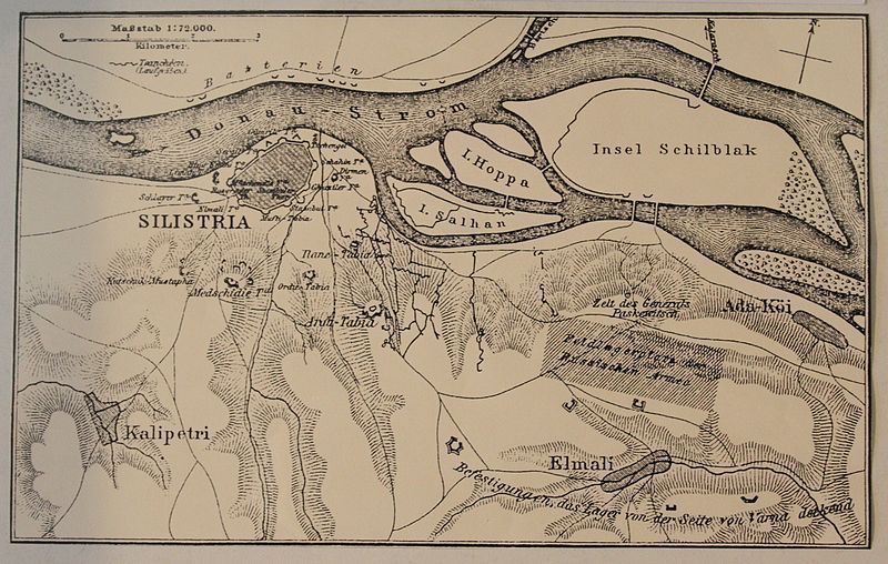
| Описание |
Deutsch: Lageplan der russischen Belagerung |
|||
| Дата | ||||
| Източник | Archiv Festung SAilistra | |||
| Автор | Ottoman Empire | |||
| Права (Повторно използване на файла) |
|
.svg)
История на файла
Избирането на дата/час ще покаже как е изглеждал файлът към онзи момент.
| Дата/Час | Миникартинка | Размер | Потребител | Коментар | |
|---|---|---|---|---|---|
| текуща | 19:22, 19 август 2012 | | 1500 × 952 (612 КБ) | Gonzosft | {{Information |Description ={{de|1=Lageplan der russischen Belagerung}} |Source =Archiv Festung SAilistra |Author =Ottoman Empire |Date =1878 |Permission ={{PD-Ottoman}} |other_versions = }} |
Използване на файла
Следната страница използва следния файл:
Глобално използване на файл
Този файл се използва от следните други уикита:
- Употреба в de.wikipedia.org
- Употреба в fr.wikipedia.org
- Употреба в ru.wikipedia.org