Файл:Wielkopolskie mapa fizyczna.png
Размер на този преглед: 473 × 599 пиксела. Други разделителни способности: 189 × 240 пиксела | 379 × 480 пиксела | 607 × 768 пиксела | 809 × 1024 пиксела | 1618 × 2048 пиксела | 2665 × 3374 пиксела.
Оригинален файл (2665 × 3374 пиксела, големина на файла: 918 КБ, MIME-тип: image/png)
| Този файл е от Общомедия и може да се използва от други проекти.
Следва информация за файла, достъпна през оригиналната му описателна страница. |
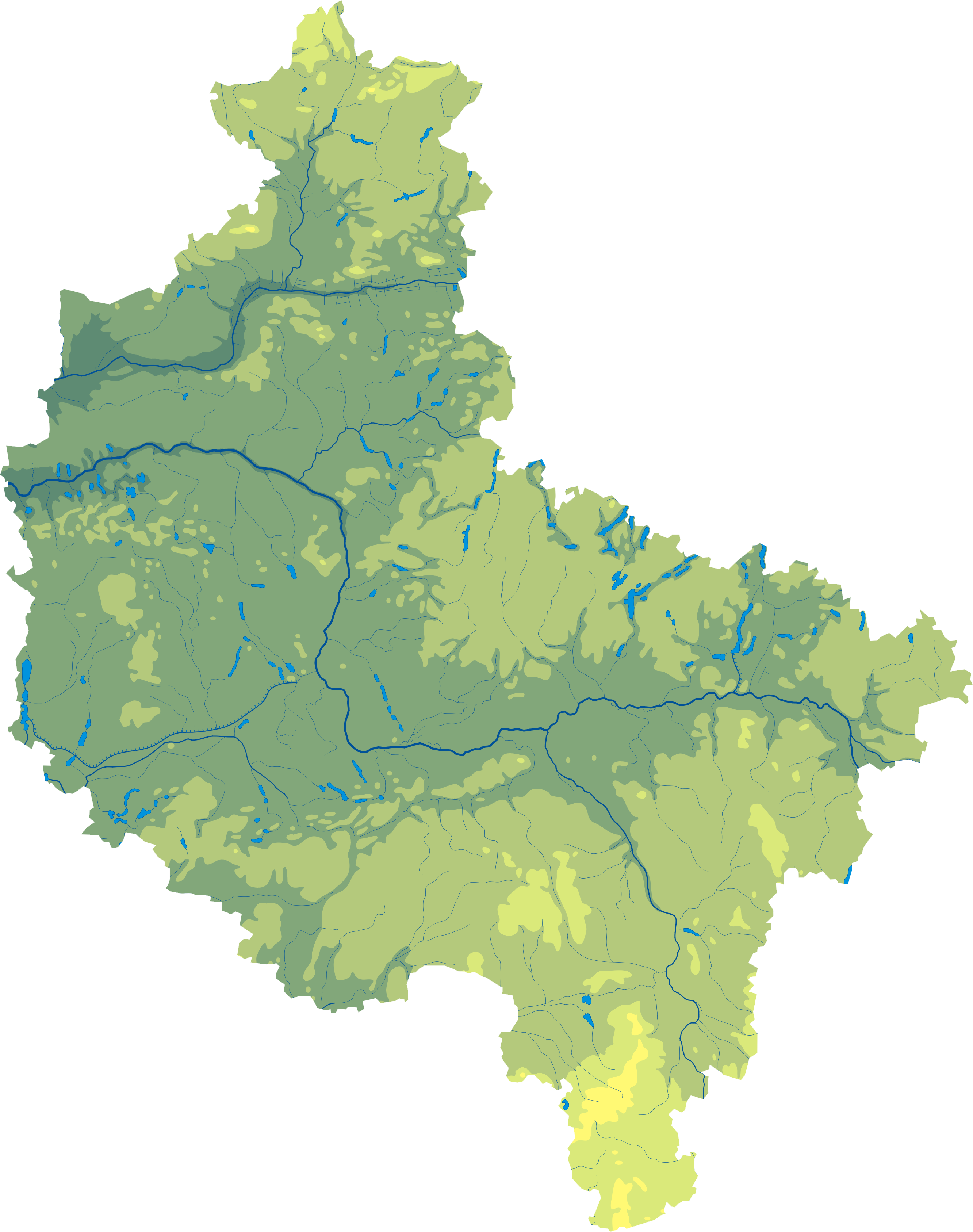
| Описание |
Polski: Mapa wód i ukształtowania powierzchni województwa wielkopolskiego.
Współrzędne graniczne mapy:
English: Relief map of Greater Poland Voivodeship. |
||
| Дата | |||
| Източник | Wielkopolskie mapa fizyczna, which was created and published under GFDL-self by Aotearoa. | ||
| Автор | Aotearoa | ||
| Права (Повторно използване на файла) |
|

Legend

История на файла
Избирането на дата/час ще покаже как е изглеждал файлът към онзи момент.
| Дата/Час | Миникартинка | Размер | Потребител | Коментар | |
|---|---|---|---|---|---|
| текуща | 11:05, 29 октомври 2012 | | 2665 × 3374 (918 КБ) | Aotearoa | drobne techniczne |
| 06:14, 8 февруари 2007 |  | 548 × 691 (118 КБ) | Bonas | {{Information |Description= Relief map of Greater Poland Voivodeship. |Source= Wielkopolskie mapa fizyczna, which was created and published under GFDL-self by [[:pl:Wikipe |
Използване на файла
Следните 46 страници използват следния файл:
- Вжешня
- Винна Гора (Великополско войводство)
- Волщин
- Вонгровец
- Гнезно
- Гостин
- Гроджиск Велкополски
- Жележница (Великополско войводство)
- Жулч
- Злотов
- Калиш
- Качори (Пилски окръг)
- Кемпно
- Коло (Великополско войводство)
- Конин
- Костшинек
- Кошчян
- Кротошин
- Лешно
- Лобженица
- Любон
- Мендзиход
- Мошчиска
- Нежихово
- Нови Томишъл
- Оборники
- Остров Велкополски
- Остророг
- Остшешов
- Пила (град)
- Плешев
- Познан
- Променко
- Равич
- Сважендз
- Слупца
- Турек
- Тшчянка
- Ходжеж
- Хутка
- Чарнков
- Шамотули
- Шрем
- Шрода Велкополска
- Ярочин
- Шаблон:ПК Полша Великополско войводство
Глобално използване на файл
Този файл се използва от следните други уикита:
- Употреба в be.wikipedia.org
- Употреба в ce.wikipedia.org
- Употреба в de.wikipedia.org
- Употреба в hu.wikipedia.org
- Употреба в lv.wikipedia.org
- Употреба в pl.wikipedia.org
- Употреба в pt.wikipedia.org
- Употреба в uk.wikipedia.org