Оригинален файл(Файл във формат SVG, основен размер: 200 × 236 пиксела, големина на файла: 157 КБ)

Емблемата на Общомедия Този файл е от Общомедия и може да се използва от други проекти.

Следва информация за файла, достъпна през оригиналната му описателна страница.

Резюме

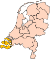
Описание Location of the province of Zeeland in the Netherlands.
Дата
Източник Own work, based on freely available GIS data
Автор User:Mtcv
Права
(Повторно използване на файла)
Data: attribution required; my work: PD
други версии I attempted to make an svg version of Image:Zeeland-Position.png (with less simplified boundaries)

Clickable version

South HollandNorth HollandFrieslandGroningenDrentheFlevolandOverijsselGelderlandUtrechtLimburgNorth BrabantZeeland

Лицензиране

© Притежателят на авторските права на този файл, Centraal Bureau voor de Statistiek, позволява на всекиго да използва файла за всякакви цели при условие, че му е оказано съответното признание. Разпространяването, производните работи, комерсиалната и всякаква друга употреба са изрично разрешени.

VRT Wikimedia

Разрешението за ползване на тази творба се намира в архива на тикет-системата VRT на Уикимедия; и е достъпна оттук за потребителите със сметка там. За удостоверяване на разрешението, моля, свържете се с потребител с такава сметка.

Ticket link: https://ticket.wikimedia.org/otrs/index.pl?Action=AgentTicketZoom&TicketNumber=2007041210008226
Find other files from the same ticket: SDC query (SPARQL)

This image is (in part or entirely) based on geographical data from Statistics Netherlands (Centraal Bureau voor de Statistiek). Digital geometry files in ESRI format can be downloaded from their website [1].

In particular, boundary data of statistical districts is based on either the Wijk- en buurtkaart 2005, or the Wijk- en buurtkaart 2003 ("CBS/TOPgrenzen"). Data on localities (bevolkingskernen) are from the publication Bevolkingskernen in Nederland 2001.

Conditions of use (in Dutch):

  • Bij visualisering van gegevens met behulp van het digitale bestand Wijk- en buurtkaart 2005 dient te worden vermeld:
Bron: © 2006, Centraal Bureau voor de Statistiek / Topografische Dienst Kadaster
  • Bij visualisering van gegevens met behulp van het digitale bestand CBS/TOPgrenzen dient te worden vermeld:
Grenzen ondergrond: © 2003, Centraal Bureau voor de Statistiek/Topografische Dienst Kadaster
  • Bij visualisering van gegevens met behulp van het digitale bestand "Bevolkingskernen 2001" dient te worden vermeld:
Bron: © 2005, Centraal Bureau voor de Statistiek

Unless otherwise specified, data on waterways and lakes are from the public domain Digital Chart of the World.

Annotations
InfoField
This image is annotated: View the annotations at Commons

Описания

Add a one-line explanation of what this file represents

Items portrayed in this file

изобразен обект

copyright status английски

copyrighted английски

3 октомври 2006

История на файла

Избирането на дата/час ще покаже как е изглеждал файлът към онзи момент.

Дата/ЧасМиникартинкаРазмерПотребителКоментар
текуща17:21, 2 март 2019Миникартинка на версията към 17:21, 2 март 2019200 × 236 (157 КБ)Thaytsupdate
00:49, 3 октомври 2006Миникартинка на версията към 00:49, 3 октомври 2006200 × 236 (158 КБ)Mtcv{{Information| |Description=Location of the province of Noord-Holland (North Holland) in the Netherlands. |Source=Own work, based on freely available GIS data |Date=2006-10-03 |Author=User:Mtcv |Permission=Data: attribution required; my work: PD |othe

Следната страница използва следния файл:

Глобално използване на файл

Този файл се използва от следните други уикита:

Преглед на глобалната употреба на файла.

Метаданни